 Ltd last checked 12/05/2021.")


Longdin & Browning has been providing innovative survey solutions throughout the world since 1965. We are one of the largest, longest-serving independent topographical survey companies in the UK, and as such can provide a service based on experience and accumulated expertise. Using the latest mapping technologies, our highly motivated, multi-disciplinary survey teams can offer the following:
These are our core services, but the supporting infrastructure at Longdin & Browning means we can offer innovative solutions to just about any measurement problem. By expanding our facilities, we’ve been able to become more flexible in our operations, which in turn has allowed us to meet the ever-growing demands of our customers.
This has resulted in a quality-driven, customer-focused service. We will do everything we can to provide a measurement solution that’s right for you.
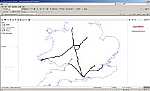
Our survey teams can be rapidly deployed to any worldwide destination. We have offices in the UK, the USA and the Middle East, and have personnel available in over 65 countries.
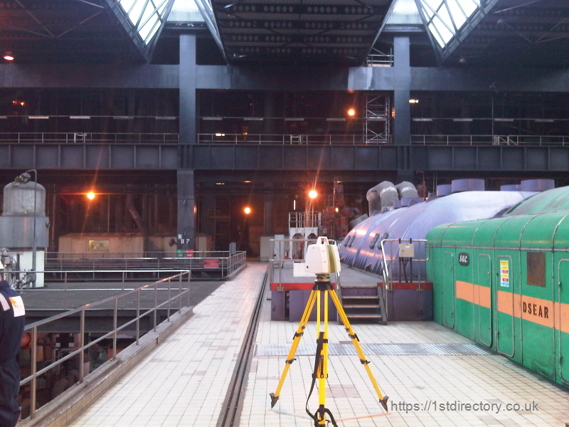
Longdin & Browning’s survey crews are equipped with the latest, state-of-the-art data capture equipment from world-class manufacturers such as Leica and Trimble. Surveys can be carried out virtually anywhere in the world, even in the most inhospitable conditions, and no matter how large or small the project, we’ll always be happy to take it on. Gathered data is part-processed onsite to confirm that accuracy criteria are being met; it is then transmitted to our offices for final processing.
Services provided by Longdin & Browning survey teams include:
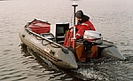
Longdin & Browning owns a large number of fully equipped, trailer-mounted survey launches ready for immediate deployment throughout the UK and Europe. But, because of their modular design, our instruments can be fitted onto virtually any vessel, which means hydrographic land surveys can be carried out anywhere in the world. Bathymetric surveys are undertaken using the latest satellite positioning techniques, with heave-compensated, dual-frequency echo sounders linked for automated data capture, providing fast and precise processing.
Hydrographic land surveys include:
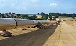
Longdin & Browning surveyors often play a key role in the design and construction of civil and mechanical engineering projects, helping to ensure successful completion on time and within budget. Our experience in measurement technology, together with our customer-orientated approach, enables us to offer innovative solutions to even the most complex survey and setting out problems.
Services include:
For more information, please head over to the Longdin & Browning website or contact us on 01792 644 181.
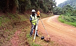
Longdin & Browing is one of the largest independent topographical survey companies in the UK. We offer a service based on experience, but use measurement techniques based on modern technology. Our land surveying services cover:
If you would like to find out more about any of these services, please contact us on 01792 644 181.
Our willingness to meet client requirements has seen us develop several additional services that support our traditional surveying activities, including:
We can also offer a number of software products. Visit Longdin & Browning online to find out more.
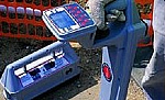
Underground utility mapping provides projects with accurate, up-to-date information relating to underground services, including communications, water, gas and electricity. The depth of the investigation depends on the site, but is usually between two and three metres. There are three main techniques used to map underground utilities:
Info
| Registration Number: | 01077561 |
| VAT Number: | GB207 8819 43 |
| Registered at Companies House: | 19 October, 1972 (51 years and 6 months ago) |
| No of Employees: | 51-100 |
| Annual Turnover: | 2-5m |
| Importers: | |
| Exporters: |
Opening Times
| Monday | 09:00 AM - 05:30 PM |
| Tuesday | 09:00 AM - 05:30 PM |
| Wednesday | 09:00 AM - 05:30 PM |
| Thursday | 09:00 AM - 05:30 PM |
| Friday | 09:00 AM - 05:30 PM |
| Saturday | Closed |
| Sunday | Closed |
Follow Longdin & Browning (Surveys) Ltd on:


To view more detailed financial information for this company click here.


