


We provide software design and development services, and support a wide range of geological and scientific software. Our products are used in industry, research, and education, and we also have extensive experience of developing software for instrumentation control, communications, data processing, analysis, and display. Working across the UK, Ireland, and Europe, we work with academics, as well as the exploration, drilling, quarrying, mining, engineering, and construction sectors. Established in 1985, our team includes knowledgeable and experienced staff who have worked in geology and other fields.
Whatever your needs, our team is here to help you find a practical solution that suits your application area. Whether it's blast design, borehole logging, drill automation, map production, or automatic digitising, we can help find the products that will make your company run more efficiently. We also offer training courses in your place of work, remote training sessions, and excellent support to ensure your new system is easily integrated.
Our Golden Software range includes:
Surfer – A powerful contouring and 3D mapping application that allows you to create vector maps, shaded relief maps, and much more.
Mapviewer – The affordable way to create publication quality thematic maps.
Grapher – An easy technical graphing package that allows you to create 2D graphs of publication quality.
Didger – The easy way to combine data files from different co-ordinate systems to a versatile digital format.
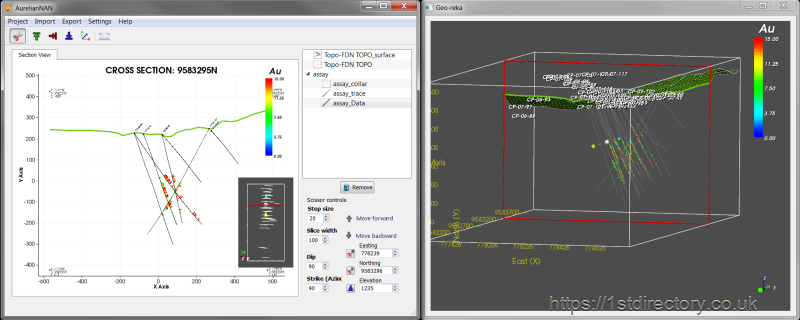
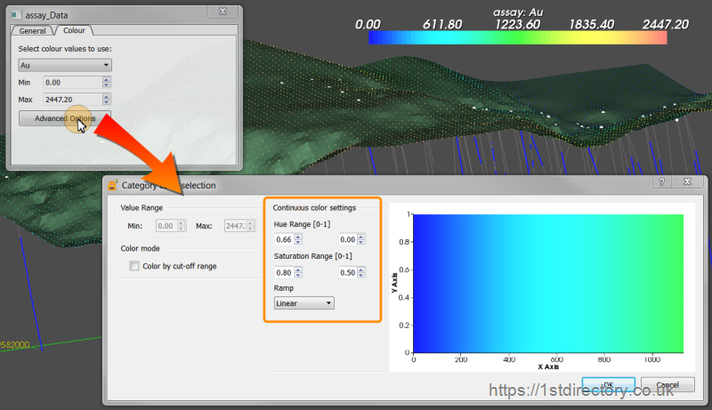
Strater -Well log and borehole plotting program for Geoscientists.
Voxler – Import data from a range of sources to create stunning 3D graphics.
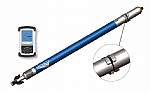
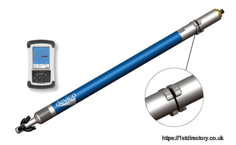
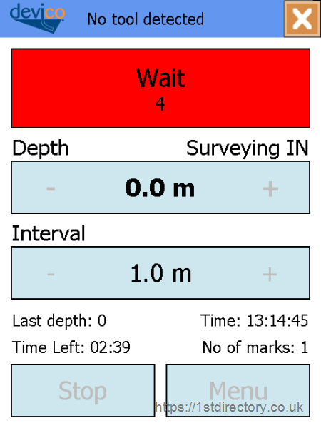
Using a simple wireline system, the Deviflex allows you to easily survey inside casings and drill strings. Pump the tool into the hole and pull it out at given intervals, there's no need to worry about magnetic influences, and there are two independent measuring systems. One for inclination and change in azimuth, and one for gravity vector, temperature, and battery capacity. The Deviflex can be used for horizontal and vertical holes, and communicates with your PDA through a USB modem. The data can then be downloaded, analysed, and plotted as needed.
GTILT & GTILT PLUS software allows you to easily handle slope inclinometer data. Supporting equipment such as probes, readouts, and loggers from various manufacturers, the plot of current data is visible at all times, as well as allowing easy access to your raw data via the 3D readings editor. The Mitre range also includes GSLOPE, used by geotechnical engineers to easily perform limit equilibrium slope stability analysis of natural and man-made slopes. Even complex geometries with up to 20 material types can be handled, and GSLOPE uses any consistent system of units. Whether it's a reinforced or unreinforced slope, this software allows you to easily draw slopes on screen, and when you modify the slip surface, the factor of safety is immediately updated.
The TLC Winprof from Geo MEM Ltd uses laser face and borehole surveying instruments for both the design and control of bench blasts. This allows you to plan and design your blast charge requirements, with have the ability to edit raw data, giving you an excellent degree of accuracy as well as flexibility. Equally importantly, you will be able to meet all legal requirements, as the reports generated show exactly what was done. There is a great deal of detailed information on the TLC Winprof on our website, including a comprehensive PDF brochure, so do have a look.
At Geo MEM Ltd we provide quality products from the Pangaea Scientific range. The SpheriStat facilitates plotting and analysing from field data and is applicable to stereonets, structural maps and rose diagrams. Another product from this range is the Orion, which uses satellite imagery to measure attitudes of geological strata, as well as other structures. A third product from the Pangaea range is the MyFault, used to calculate stresses by analysing fault and slip geometry. There is a good deal more detailed information about these efficient and reliable products on our website, so do have a look.
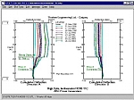
CPT-pro is designed to undertake detailed analaysis, interpretation and presentation of CPT (Core Penetration Testing) soundings. With a high level of flexibility, our CPT-pro can use data from a wide range of CPT systems. Additionally, open data exchange and transfer is achieved with many other systems. The CPT-pro contains graphics tools that will enable you to export geotechnical and geological diagrams to external applications, such as graphics and word processing programmes and CAD. You can see more about the versatile CPT-pro on our website.
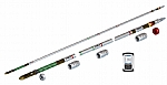
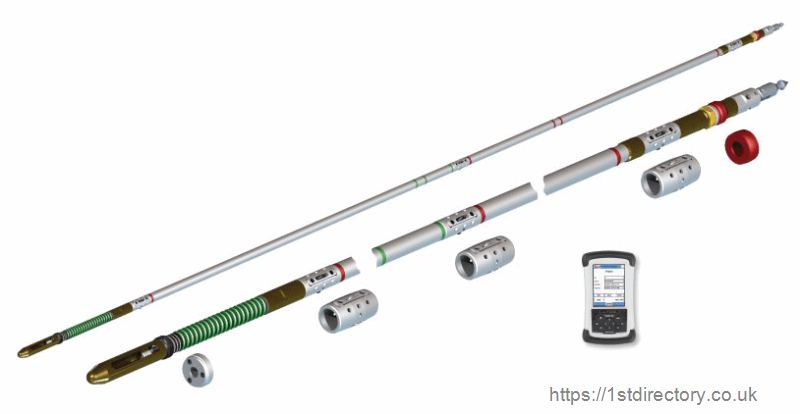
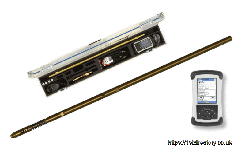
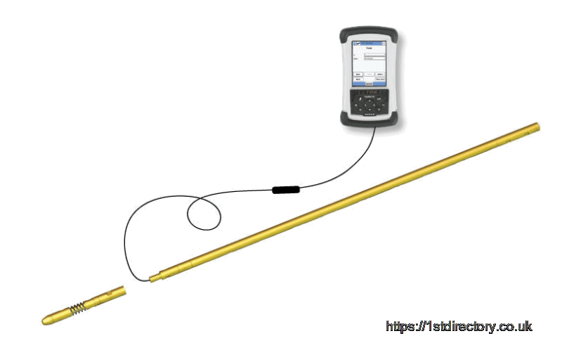
The PeeWee is a compact multishot borehole survey instrument, which manages to pack in many features. Using three high-accuracy magnetometers and accelerometers, the PeeWee is used to survey open or cased boreholes, grout curtains, and blast holes. Set time intervals for five seconds and up to record inclination, azimuth, toolface, temperature, gravity vector, magnetic field vector, and magnetic dip angle. With a diameter of just 30mm, it can be used to survey through the DeviDrill bit, meaning your core barrel can stay down the hole while the survey is performed.
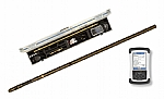
The DeviCore DC makes it easy to register the orientation and inclination of boreholes. Simply put the probe into your inner tube and secure with the expansion pads. The DeviCore DC is easily adjusted, and is supplied in a small case making it easy to transport. A quality check can be performed with the DeviCore DC registering the Earth's gravity vector, and tool temperature and battery voltage is also stored for your convenience. This item is non-magnetic, making it ideal for use in most casing and drill string surveying, and the rugged Windows handheld unit makes it easy to use out in the field. Set up, download results, and present them with our simple software.
It doesn't matter if your project is small, large, ongoing, or short term, we can provide the knowledge and expertise to ensure it runs smoothly. As well as complete software, we work with electronic design, hardware, and design and development services. Our expertise includes data processing and calculations, data conversion and import / exports, and textual and graphic displays. We work with data communication, ensuring our specialist devices easily sync with PCs for analysis and reporting of field data. Our work has included rock sample databases, borehole logging, soil analysis software, and processing software for a wide range of applications.
Many customers use our remote training and support services, benefitting from individualised instruction and help with software problems. It is very easy to access this service. Set up is easy and can be completed in only five minutes. We use the reliable and safe Team Viewer system, so it’s sure to be secure. Remote training involves one to one or one to two software instruction and is the ideal way to answer your specific questions. Using our remote support will significantly reduce the time and expense spent in troubleshooting, as our expert staff will be able to see you actually operating the software and can then quickly diagnose any problem. If desired, they can also set up and install your original or upgrade software. With remote training and support you have an expert at hand whenever you need one.
Our training courses are designed for professionals, and are led by a geologist with experience in academic and exploration work. Trainees can quickly become proficient with their new software and instruments, and our training is offered onsite, at our premises near Dundee, or online using Skype and TeamViewer. Our courses offer an introduction to Surfer, or an advanced level course which includes writing Visual Basic scripts. We also have courses for Strater and MapViewer that can be arranged to suit your needs, and we have worked with several high profile companies in the past.
Our Rockware range includes:
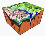
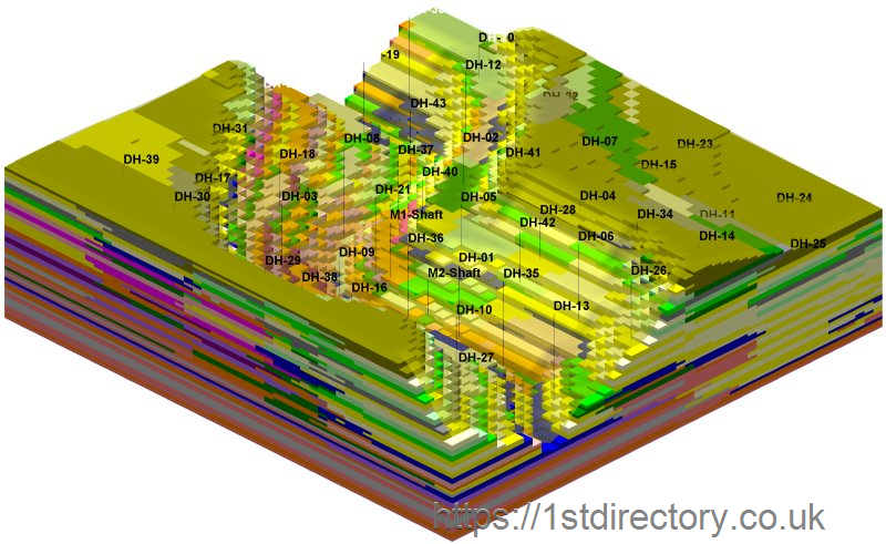
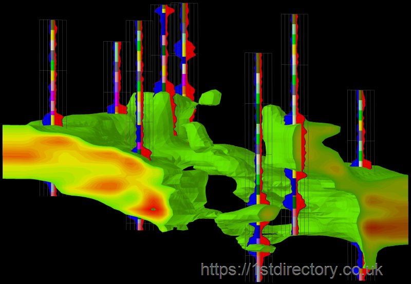
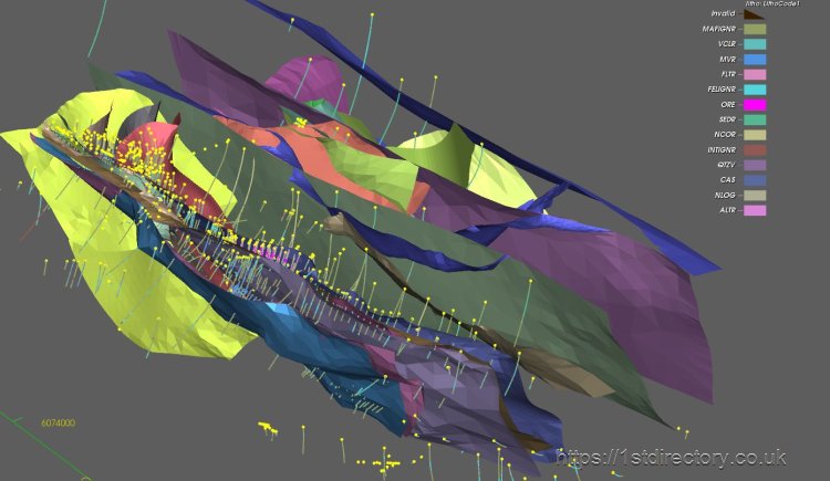
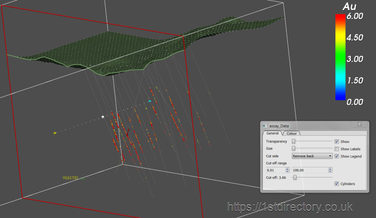
Rockworks – Geological data management, analysis, and display application. Create borehole and XYZ data based maps, as well as 3D solid models and lithology solids.
LogPlot -A borehole log plotting application that allows storage of lithology pattern information and free-form data entry.
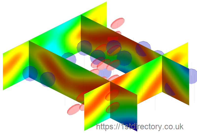
Rockware GIS Link – Generate cross-sections, profiles, fence diagrams, contour maps, and much more with ease.
RockWorks Utilities – Create contour maps, 3D surfaces, terrain models,volumetrics, pipe diagrams, and more with this collection of geological mapping, modeling, analysis and display tools.
Info
| Registration Number: | SC266547 |
| VAT Number: | GB400 9002 16 |
| Registered at Companies House: | 15 April, 2004 (20 years ago) |
| No of Employees: | 1-10 |
| Annual Turnover: | 0-200k |
| Importers: | |
| Exporters: | |
| Company Type: |
|
Opening Times
| Monday | 09:00 AM - 05:30 PM |
| Tuesday | 09:00 AM - 05:30 PM |
| Wednesday | 09:00 AM - 05:30 PM |
| Thursday | 09:00 AM - 05:30 PM |
| Friday | 09:00 AM - 05:30 PM |
| Saturday | Closed |
| Sunday | Closed |
Follow GeoMEM Ltd on:


To view more detailed financial information for this company click here.


