


SJ Geomatics is a surveyors company based in East Anglia. We offer a first class nationwide service at competitive prices. With more than 18 years in the industry we have a wealth of experience and have built a fantastic reputation for providing customers with a reliable service. We use state of the art equipment in order to produce accurate results. We work for various national companies, building companies, local authorities, facilities managers, structural engineers, architects, aborists, landscape architects and more.
Our services include:
3D laser scanning is a method used to collect high density spatial data sets much faster than other traditional methods. The laser scanner emits a laser horizontally and vertically rotating through 360 degrees and the reflections are detected. Our highly skilled team uses the surveyed points to produce 2D drawings, 3D models or simple jpeg images. Data can also be interfaced with other CAD platforms to allow as-built and new design data to be integrated for clash and coordination checks being accurately positioned using OS data, National Grid and GPS coordinates.
We can also use data from our Measured Building Surveys or Topographical Surveys to supply you with the area calculation of land, fields, gardens, paddocks, allotments, swimming pools, building plots, buildings, rooms, windows, garages, car parks and driveways. Our experienced surveyors can also measure other levels to calculate the volume of soil, concrete, water, shingle, bricks, wood and other materials required for your construction project. Please contact us at SJ Geomatics for further information regarding our Measured Building Surveys, Topographical Surveys and for a no obligation quotation.
We use the latest software to provide Measured Building Surveys. We issue floor plans, building elevations and building sections for all shapes and sizes of buildings. We work with individual clients through to commercial developers providing each with the same high standard of service. Our Measured Building Surveys are widely used for projects and applications such as scaled floor plans, licensing plans, elevations, internal elevations, street scenes, photogrammetry, roof plans, right of light surveys. Net internal area surveys, energy assessments and more. Our building surveyors meet all the criteria for submission of the planning authorities and land registry.
We use GPS to carry out large site surveys quickly and efficiently. We are also licensed to download and copy Ordnance Survey data in-house as well as to issue drawings to clients. Our GPS land surveys provide accurate positioning of physical features that can be used in maps and models. GPS land surveys are widely used for flood risk assessments, boundary surveys which overlay with OS data, large scale topographical surveys at a fraction of the cost, real-time setting out, locate industrial and historic features and identify areas of encroachment over time.
SJ Geomatics uses Ground Penetrating Radar (GPR) and Radio Frequency Location (RFL) to conduct accurate underground surveys that allow you to identify and make use of existing utilities services as part of a construction project. This will also help to prevent accidental damage to utility infrastructure caused by groundworks. Our on-site surveyor will provide you with accurate plans that show lines of manhole runs as well as the location of electric, gas, cable TV and water pipes (with information on depth, size, type and configuration also included in the report). Find out more about this service by visiting SJ Geomatics online.
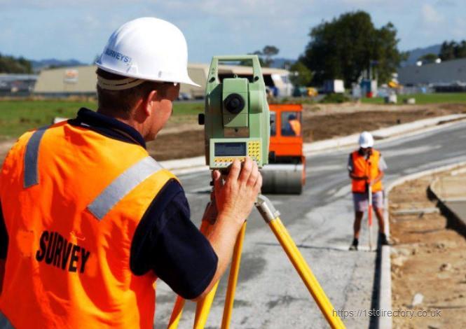
Topographical land surveys are an essential requirement for any construction or development project. At SJ Geomatics we have a team of experienced land surveyors who are fully qualified to carry out the following topographical surveying procedures:
The use of calibrated Leica® instrumentation ensures exceptional accuracy with survey taken. Find out more about this service by visiting SJ Geomatics online.
Info
| Registration Number: | 08081329 |
| VAT Number: | |
| Registered at Companies House: | 24 May, 2012 (11 years and 11 months ago) |
| No of Employees: | 1-10 |
| Annual Turnover: | 0-200k |
| Importers: | |
| Exporters: | |
| Company Type: |
|
| UK Branches: | Suffolk, Peterborough |
Opening Times
| Monday | 09:00 AM - 05:30 PM |
| Tuesday | 09:00 AM - 05:30 PM |
| Wednesday | 09:00 AM - 05:30 PM |
| Thursday | 09:00 AM - 05:30 PM |
| Friday | 09:00 AM - 05:30 PM |
| Saturday | Closed |
| Sunday | Closed |
Follow SJ Geomatics on:


| ISO 9001:2015 - Quality management systems – Requirements |
| ISO 14001:2015 - Environmental management systems – Requirements with guidance for use |
To view more detailed financial information for this company click here.


